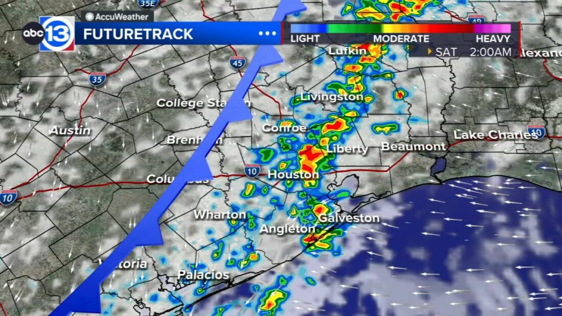
HOUSTON, Texas (KTRK) — We started off Friday messy with scattered showers moving through SE Texas. More scattered showers will be expected into the afternoon and evening with isolated storms also possible. Overnight tonight, we are expecting a weak cool front to move in which should draw in a broken line of showers and storms. This line should pretty much be east of SE Texas by about 9-10 am Saturday morning. Scattered rain is still possible behind the front Saturday.
When can we expect temperatures to really cool off again?
There is another Pacific front coming through Texas this weekend, but we have to wait until after the weekend to get a more significant dose of cooler air back in Southeast Texas. Our next cold front is penciled in for Wednesday of next week, and that one should drop lows into the 50s and highs into the 70s, which is fairly typical for November.
What can we expect for the weekend?
Rain chances will increase to 60% Friday night as the next Pacific cool front blows in. Temperatures will start in the mid 60s and warm into the upper 70s on Saturday with rain chances dropping from 40% in the morning to just 20% during the afternoon. Sunday’s rain chance holds at 20% with a similar temperature range.
What are you tracking in the tropics?
Rafael is still a hurricane over the Gulf of Mexico as it tracks westward over the open water. It still looks like conditions remain hostile for Rafael in the Gulf, so we anticipate weakening as it tracks toward the Bay of Campeche. No impacts are expected here in SE Texas except for possibly elevated surf and increased rip currents. Head to our daily Tropical Update page for a complete look at what we’re covering in the tropics.


